







Picking the wrong drone on a high-stakes build is a very expensive mistake.
One delayed flight, one data gap, one platform that can’t manage the jobsite — and your project is weeks behind. The right drone platform is the difference between real-time visibility and guessing games.
Here’s the good news:
Trusted Platforms Are no Myth There are tried and tested ways to choose a platform that works. Not the flashy consumer grade. Genuine industrial-grade tools that survey, map, and provide data your team can rely on.
Here’s what’s inside:
- Why Drone Platforms Matter On High-Stakes Projects
- What Makes Construction Drones Different?
- 5x Things To Look For In A Drone Platform
- Common Mistakes That Sink Projects
Why Drone Platforms Matter On High-Stakes Projects
High-stakes construction projects have zero room for error.
Bridges, dams, highway widenings, large commercial construction — these projects are sized in millions of dollars and thousands of hours. A minor error in the survey information can propagate into expensive rework.
Think about it:
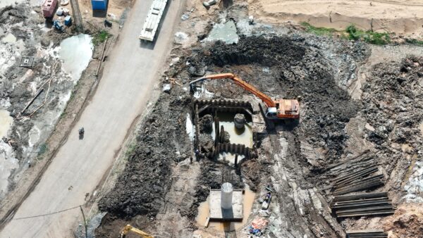
The drone is the eyes of the project. It is collecting topographic data, progress tracking, safety hazard spotting and populating models into BIM software. If the platform is unreliable, the data is unreliable. And if the data is unreliable… the entire project suffers.
Studies have indicated that drone surveys can save up to 45% in project duration and 50% in field costs. That kind of return only comes when the platform is architected for the task.
The Risk Of Picking Wrong
Getting this wrong creates serious problems, like:
- Data gaps that force repeat flights
- Downtime when the drone can’t handle weather
- Security issues with non-compliant platforms
- Cost overruns from slow processing workflows
These issues don’t just slow you down — they can blow up your budget.
Why Geospatial Data Collection Matters So Much
Geospatial data collection is at the heart of construction today. It powers site planning, earthworks, progress monitoring and as-built verification.
If your spatial data collection is good, everything works. If your spatial data collection is bad, nothing downstream will work.
Construction companies are seeking a DJI alternative for surveying and mapping as they require platforms that adhere to rigid data security standards and are also capable of capturing long-range, high-precision geospatial data across multifaceted job sites. This transition is occurring rapidly – and for good reason.
What Makes Construction Drones Different?
Construction drones aren’t like hobby drones. Not even close.
A jobsite is a harsh environment to fly in. Dust, wind, metal interference, restricted airspace and constant movement from workers and equipment. Your drone platform has to withstand it all without skipping a beat.
A proper construction drone needs:
- Long flight times for large sites
- High-resolution sensors for accurate mapping
- RTK or PPK support for survey-grade accuracy
- Durable build quality for rough conditions
The shift is already happening rapidly. The global construction drone services market is expected to be worth USD 1.74 billion by 2025 and at a CAGR of 23.4%, it is expected to reach USD 14.28 billion by 2035.
And here’s the kicker…
Austrian construction giant STRABAG says drones allow them to do surveys with up to 75% less GCP set up time. You can’t get results like that without the right platform behind you.
5x Things To Look For In A Drone Platform
But wait, so what exactly should you be looking for? Here are the 5 most important factors that separate the winners from the losers.
1. Survey-Grade Accuracy
This is a MUST for mission critical applications. Your platform must provide cm-level precision, consistently.
Look for drones that support:
- RTK (Real-Time Kinematic) positioning
- PPK (Post-Processed Kinematic) workflows
- Compatibility with Ground Control Points
When you’re building something expensive, “close enough” is never enough.
2. Payload Flexibility
The best platforms let you swap payloads for different missions.
One day you need a high-res RGB camera for progress photos. The next day you need LiDAR for dense terrain. The day after, a thermal sensor for electrical gear.
Having to purchase a separate drone for each task is a colossal waste of funds.
3. Data Security & Compliance
This is something a lot of construction firms overlook…
An increasing number of public (and many private) infrastructure projects now mandate platforms with high-grade data security. NDAA-compliant drones have become the baseline for government-sanctioned work in the US.
If your platform does not align with these rules, you could be excluded from the largest contracts on the table.
4. Flight Time & Range
Big sites need drones that can go the distance.
Industrial-strength platforms are now capable of 40+ minute flights. That means you can cover hundreds of acres per flight. With fewer batteries and takeoffs, you spend less time launching and more time working.
5. Software & Workflow Integration
The drone is only half the story. Your platform needs to plug into the software your team already uses, like:
- BIM platforms (Revit, Navisworks)
- GIS tools (ArcGIS, QGIS)
- Point cloud processors (Pix4D, ContextCapture)
Without seamless integration, you just create another data silo — and that costs time and money.
Common Mistakes That Sink Projects
Highly experienced teams still mess up when selecting a drone platform. These are the 5 biggest howlers.
Buying Purely On Price
Cheap drones seem like a good deal until they fail on site.
A $2,000 drone that misses a key survey metric could cost you $200,000 in rework. The numbers don’t add up. Choose a platform designed for the size of your jobs.
Ignoring Training Requirements
A high-end drone platform is only as good as the pilot flying it.
Make sure your team gets proper training on:
- Flight operations and safety
- Data processing and QA
- Regulatory compliance (Part 107 in the US)
Otherwise you’ll have great tools… and no one who knows how to use them.
Skipping The Demo
Never purchase an industrial drone before flying it. The good manufacturers will schedule a demo on your site for you so you experience first-hand how that platform performs under your conditions prior to spending the money.
Bringing It All Together
Selecting the appropriate drone platform for a mission critical construction project isn’t simply a procurement decision — it’s a project risk management decision.
Get it right and you unlock:
- Faster project timelines thanks to quick surveys and real-time data
- Lower costs from reduced labor and minimal rework
- Better safety by keeping workers out of hazardous zones
- Happier clients because deliverables are clean and accurate
Quick recap:
- Focus on survey-grade accuracy first
- Look for payload flexibility
- Prioritise data security and compliance
- Check flight time and range
- Make sure it integrates with existing software
Pick the right platform, and your projects will run smoother than ever.