
When it comes to architectural design, understanding the landscape is as crucial as the creativity behind the blueprints. A topographical survey, which provides a detailed representation of the terrain, is an essential tool for architects. Whether you’re designing a residential property, a commercial complex, or a public infrastructure project, having an accurate depiction of the land’s features can make a significant difference in the success of your project. This blog will explore why every architect should consider a topographical survey before diving into the design phase, highlighting the various benefits and practical applications of this critical step.
What is a Topographical Survey?
According to Matt Jaglowitz, CEO of Exactus Energy, a topographical survey is a detailed and precise mapping of the physical features of a piece of land.
A topographical survey is a detailed and precise mapping of the physical features of a piece of land. This includes natural elements like hills, valleys, trees, and streams, as well as man-made structures such as buildings, roads, and fences. By capturing the elevations, contours, and positions of these features, a topographical survey provides a comprehensive overview of the terrain.
The key components of a topographical survey involve:
- Elevation Data: Capturing the height of various points on the land to understand its topography.
- Contours: Lines that connect points of equal elevation, helping to visualize the terrain’s shape and slope.
- Natural Features: Identifying elements like trees, water bodies, and rocks.
- Man-made Structures: Documenting existing buildings, roads, and other infrastructure.
Modern tools and techniques used in topographical surveys include GPS devices, laser scanners, drones, and traditional surveying equipment like theodolites. These technologies ensure that the survey is accurate and comprehensive, providing architects with reliable data to base their designs on.
By understanding the lay of the land through a topographical survey, architects can make informed decisions that enhance the functionality, aesthetics, and sustainability of their projects.
Benefits of a Topographical Survey for Architects
When diving into a new project, architects must have a clear understanding of the landscape they are working with. This is where a topographical survey becomes invaluable. Here are some key benefits that make it essential for architects:
Accurate Representation of the Land
A topographical survey provides an exact representation of the land, highlighting all its features. This accuracy ensures that architects have a reliable foundation for their designs. By knowing the precise elevations, contours, and natural elements of the site, architects can create plans that are not only aesthetically pleasing but also practical and functional.
Identification of Potential Issues
A topographical survey can reveal potential problems that might not be obvious at first glance. For instance, it can identify areas prone to flooding, unstable soil conditions, or other environmental hazards. By recognizing these issues early on, architects can address them in their designs, potentially saving a lot of time and money in the long run.
Better Planning and Design Decisions
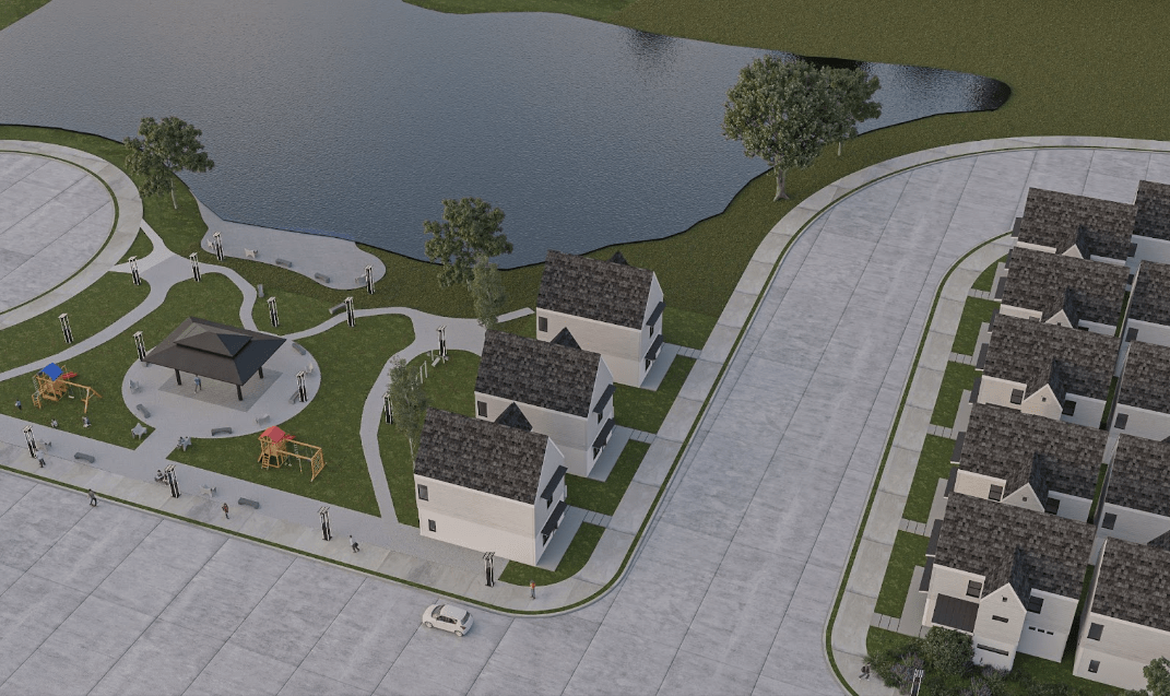
With detailed data from a topographical survey, architects can make more informed decisions. They can plan the layout of a building to take advantage of the natural terrain, optimize views, and ensure proper drainage. This leads to designs that are not only more integrated with the landscape but also more sustainable and efficient.
Improving Design Accuracy
When it comes to architectural design, precision is paramount. A topographical survey provides architects with the exact data they need to ensure every aspect of their design is accurate. By knowing the precise elevations and contours of the land, architects can create designs that fit perfectly within the existing landscape. For example, a house built on a sloping lot can be designed with tiered levels, taking full advantage of the natural incline. Additionally, technological advancements like 3D laser scanning and drone surveys have further improved the accuracy and efficiency of topographical surveys, allowing for even more precise data collection and analysis.
Cost and Time Efficiency
Investing in a topographical survey at the beginning of a project can lead to significant cost and time savings. By identifying potential issues early, architect firms can avoid costly redesigns and construction delays. For instance, discovering that a site has poor drainage or unstable soil conditions before construction begins allows for necessary adjustments in the design phase, rather than addressing these problems once the project is underway. This proactive approach not only saves money but also keeps the project on schedule. Case studies have shown that projects incorporating topographical surveys are often completed more smoothly and with fewer unexpected setbacks.
Legal and Regulatory Compliance
Navigating the legal and regulatory landscape is a critical aspect of any architectural project. A topographical survey can help ensure that designs comply with local zoning laws, building codes, and other regulations. By providing detailed information about the site, including property boundaries and existing structures, a topographical survey can help prevent legal disputes and ensure that the project adheres to all relevant requirements. This not only protects the architect and their clients but also contributes to a smoother approval process with local authorities.
Environmental Considerations
A topographical survey plays a crucial role in assessing the environmental impact of a project. By understanding the natural features of the land, architects can design buildings that harmonize with their surroundings and minimize environmental disruption. This might involve preserving mature trees, planning for effective stormwater management, or incorporating natural features into the design. Sustainable design practices are increasingly important in today’s world, and a topographical survey provides the necessary data to create environmentally responsible and aesthetically pleasing projects.
Conclusion
Incorporating a topographical survey into the architectural design process is not just a smart move; it’s essential. The benefits are clear: accurate representation of the land, identification of potential issues, better planning and design decisions, cost and time efficiency, legal and regulatory compliance, and thoughtful environmental considerations. For architects, these surveys provide a critical foundation that informs and enhances their work. By prioritizing topographical surveys, architects can ensure their designs are not only beautiful and functional but also sustainable and compliant with all necessary regulations. Ultimately, a topographical survey is an investment in the success of any architectural project, paving the way for innovative and well-integrated designs that stand the test of time.